The old restroom building in the family picnic area at Benicia State Recreation Area is mostly coming down. The state's construction notice keeps the concrete block wall, its footing, a strip of wood-and-glass windows on the north side, and the existing eave beams and ridge beam. The new building goes up on that saved north facade with about 230 more square feet than the original.
That building is one piece of an accessibility rebuild covering the parking lot, restroom and picnic area off Dillon Point Road, plus the trailhead on Sub Station Road. California State Parks expects the picnic-area work to be finished by mid-May 2027. Until then, the center of the park is a work zone. The best ways in are from its two ends: the Mike Taugher Trail on the Benicia side and Glen Cove Waterfront Park on the Vallejo side. Both ends are changing too.
A 2001 Consent Decree Is Behind the Rebuild
The Notice of Exemption filed with the state's CEQAnet database, posted February 11, 2026, explains the purpose of the project. It is meant to improve accessibility at the park and "to comply with the 2001 consent decree." State Parks calls it an Americans with Disabilities Act upgrade and lists two active construction areas in the park.
The CEQAnet notice is detailed enough to show how the picnic grounds will change:
| Part of the site | What is removed | What goes in |
|---|---|---|
| Restroom | Everything except the block wall, footing, part of the north windows, and the eave and ridge beams; all electrical | A building about 230 sq. ft. larger, two 25-foot breezeway block walls, all new fixtures |
| Parking lot | About 4,560 sq. ft. of 6-inch-deep asphalt | About 3,670 sq. ft. of new asphalt, 920 sq. ft. of concrete, 114 linear feet of curb, nine wheel stops |
| Picnic grounds | About 2,450 sq. ft. of gravel and concrete; 13 trees; three BBQs; ten picnic tables; two trash receptacles | About 7,330 sq. ft. of concrete paving around the restroom and along routes to a new accessible picnic area |
| Utilities | — | A new waterline and shutoff valve, a sewer extension, a new electrical panel, a free-standing drinking fountain |
The Picnic Ground Will Be Laid Out Differently in Spring
Thirteen trees come out, along with ten tables and three barbecues. The new concrete surrounds the restroom and runs along the routes to the new accessible picnic sites. State Parks describes the finished project as a full restroom remodel, ADA parking spaces, and "new ADA compliant paths to several ADA compliant picnic spots."
State Parks' own accessibility page says the current restroom in the middle of the picnic area is usable and has grab bars, but stall space is limited, and an accessible portable toilet stands in the parking lot. The same page says the two lots off Sub Station Road give the best access to the picnic area, the Benicia Bay Trail and the Forrest Deaner Native Plant Botanic Garden. Those lots and the trailhead are inside the project area. Before driving there this winter, call the park at (707) 648-1911 to ask what is open that week.
The Forrest Deaner garden is next to the main picnic area, before Dillon Point. It covers 3.5 acres and has been a Benicia State Parks Association program since it was established in 2001. It has more than 250 native species, accessible paths with views of Southampton Bay and the marsh, and accessible parking at its own entrance. The garden is close to the work but has its own entrance, which makes it the easiest part of the middle of the park to reach on a quiet weekday.
This Winter, Start From Either End
The park has 2 1/2 miles of road and bike paths and is open daily from 8 a.m. to sunset. While the middle is under construction, these are the ways in that don't start at the picnic lot:
- Mike Taugher Trail, from the Benicia side. The trailhead is in a small lot just off West K Street and Military West, with an accessible portable restroom. The path is part of the San Francisco Bay Trail and is generally accessible for about 0.75 mile. It runs along wetlands next to the Carquinez Strait and ends at the park's main entrance on Dillon Point Road.
- Glen Cove Waterfront Park, from the Vallejo side. The park is on Whitesides Drive in Vallejo, next to Benicia State Recreation Area. Its walking trail connects to the San Francisco Bay Trail.
- Main entrance, by car. Use the Rose Drive/State Park Road exit from I-780. A route with less freeway driving leaves I-80 at Columbus Parkway, follows it to Rose Drive and turns right into the park. A parking fee is required. State Parks' day-use schedule, dated June 2025, lists $6 per vehicle for Benicia SRA.
The Bay Trail Connects Both Ends, but Rain Changes It
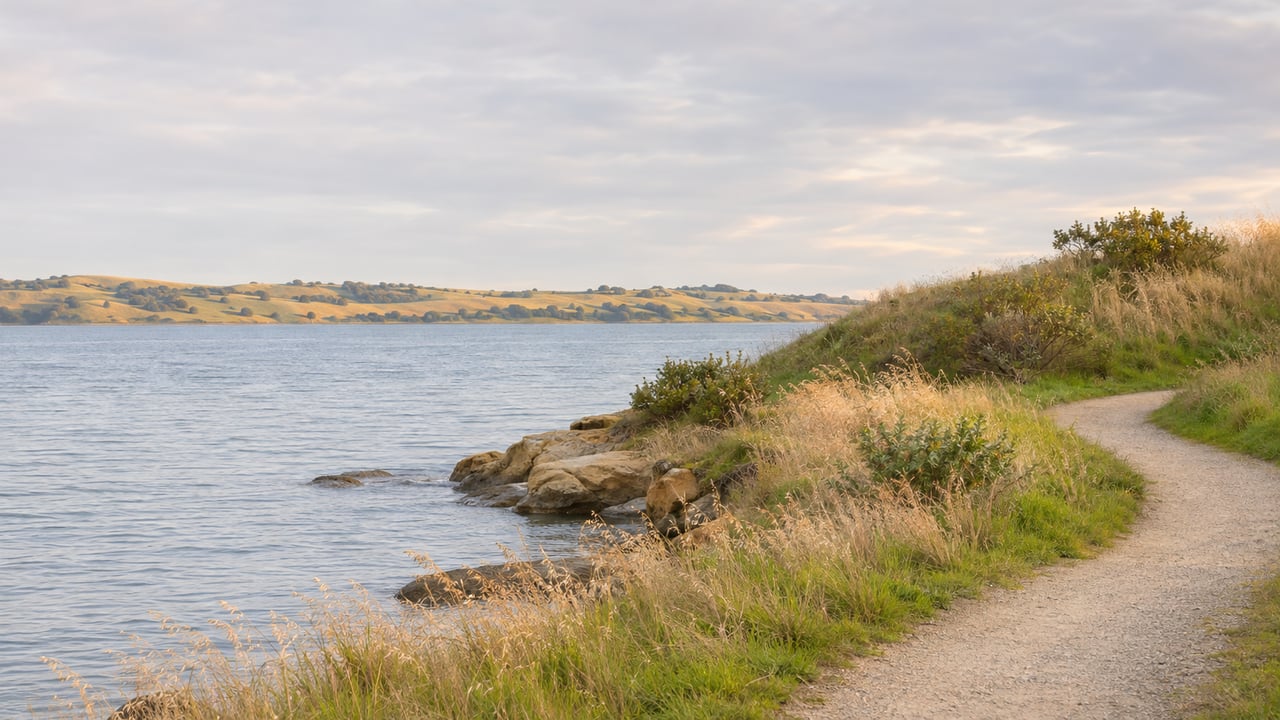
The Benicia Bay Trail is an out-and-back trail, 1.75 miles each way, that winds through the hills with views of the Carquinez Strait and Southampton Bay. Around mile 1.6 the dirt trail joins an asphalt service road and ends at Glen Cove Waterfront Park. On a normal day it starts at the picnic-area lot off Sub Station Road. This winter, Glen Cove is the other way to reach it.
Winter is when the trail surface matters. State Parks describes it as mostly compacted soil and aggregate. It is usable in dry weather, but some users may need help after heavy rain. The first 1.2 miles can narrow to 36 inches or less, with cross slopes at or above 5%. From 1.2 to 1.6 miles, parts of the trail get steeper, with running slopes at or above 8%. For a stroller or a mobility device, that section is the reason to wait for a few dry days after a storm. The paved Mike Taugher Trail is the better wet-weather choice.
Dillon Point Has Its Own Year-End Deadline
The second active construction area is out on Dillon Point, where State Parks is working on the Bay Area Ridge Trail. State Parks expects that project to be finished before the end of 2026. The marsh on Dillon Point is one of the park's most popular fishing spots, and parking there requires the fee.
The two projects run on different schedules. The trail work on Dillon Point is set to finish by year-end, while the picnic grounds are expected to take until mid-May 2027. That makes Dillon Point likely to be the first part of the park back to normal.
Glen Cove Is Being Replanted at the Same Time
On the Vallejo side, the park's western end is changing too. State Parks is working with the Solano County Resource Conservation District on the Glen Cove Waterfront Enhancement Project. It is a multiyear effort to remove non-native plants and replace them with native trees, shrubs, grasses and wildflowers that are culturally significant to the Yocha Dehe Wintun Nation. State Parks says park users may see temporary area closures, herbicide spraying and volunteer project days.
According to Solano RCD, the project started in 2021 and is paid for through an agreement between Solano County and the Yocha Dehe Wintun Nation. By 2025 more than 100 species had been planted or seeded. The next phase includes interpretive signs planned for 2026, more weed control, and more planting and seeding.
Residents can help with the work. Solano RCD holds a volunteer day at Glen Cove Waterfront Park on the third Wednesday of each month, and this month's is Wednesday, November 18. The work includes planting and weeding, and anyone is welcome. Registration is required by email to [email protected], as listed on the Solano RCD events page.
If you would rather plant natives at home, the same events page lists a Solano RCD plant sale on Saturday, November 14, from noon to 4 p.m. at Solano Brewing Company, 5500 Weber Road in Vacaville. The Jepson Chapter of the California Native Plant Society will bring plants native to western Solano County, and Morningsun Herb Farm will have culinary, medicinal and landscaping herbs.
By mid-May 2027, the picnic grounds should reopen with a larger restroom, a drinking fountain, and paved routes to accessible picnic sites. Until then, the Mike Taugher Trail and Glen Cove Waterfront Park are the ways in.
Big projects like this one can affect the streets and blocks around them, and we track them for clients in Benicia and across Solano County. If you want to talk about how changes near the shoreline fit into your plans, The Company Real Estate is a short drive away on Tennessee Street in Vallejo. Contact Us.